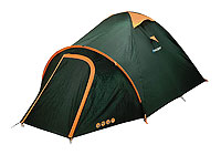
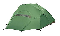
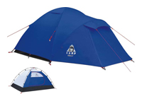
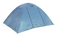
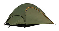
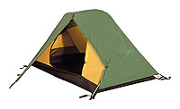
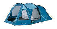
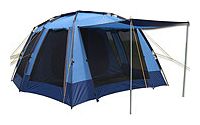
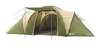
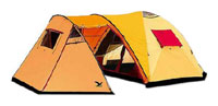
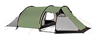
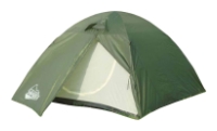
![]() International Jornal of Project Management Vol.17, No.2, pp.131-135, 1999© 1999 Elsevier Science Ltd and IPMA. All rights reserved Printed in Great Britain
PII: S0263-7863(98)00007-6
Introduction The necessity of accounting for local interests in project management is directly connected with the society steady development concept. Steadiness is not only stability and minimum relaxation of material systems for returning to stable state. Steady development also means, in particular, comprehensive notification of all the population about consequences of any infrastructure project and real democratic opportunities for each inhabitant to interfere being based on his understanding of his local interests.
The difference between local projects that are also regional in the sense they are located in a certain region, and true regional spatial projects is shown below.
Common use Strategic project management planning methodology is required to provide priority of external goals, to attain the main objective: to improve quality of life and business conditions for all businesses in the area (though to different extent) through changing consumer’s qualities of the space. Common use of project implementation results is an important feature of regional spatial projects. This gives grounds for the “local change - global response (effect)” principal which is basic to the methodology. And the point is not factual use, but potential benefits from the new qualities of the space. Construction of a bridge or pollution control system creates only conditions for using new qualities by everybody, and the decision if one should use these is up to everyone.
Regional spatial projects generate new useful (for everyone) qualities of the space. Monitoring and even managing the generation of them is an intermediate (and often independent) goal in project management. Among these there are secondary qualities such as accessibility, connectedness, mosaic composition (taken as diversity within a fixed area). Unlike primary qualities (length, inclination, etc.) secondary qualities of space can not have marks on the ground and are formed in minds of those who live in the area and use its infrastructure. For example, as a result of roads reconstruction (even without changing the length of roads) because of the traffic speed increase service centres as if become more close. This improves the quality of life of all the population of the area through reduction of the time required to get the set of services and reduction of services consumption, increase in the free time amount, decrease of migration flow, reduction of morbidity and mortality of the population thanks to more available emergency aid and specialised medical care, etc. All these advantages are real (for those who use them) or potential (for those who can use them at any moment). Secondary qualities of space evidently become apparent in network version. Therefore it is better to consider not separate objects but complex of them for improving living and business conditions in an area.
An area of any level (starting from a county up to the whole country) can be regarded as an living organism to which principals of “acupuncture” treatment can be applied. Similar to a human being any area has its special active points which upon stimulation will bring about area’s revival. The specifics of using “acupuncture” principals to an area is that the area’s spatial organisation, interaction of various objects situated within it are activated mainly through transportation links. For this reason “acupuncture” of a linear type in the form of investments stimulating separate sections of the network is preferable to the point type. The ideology of linear type “acupuncture” in regional development brings us to the solution of the eternal dilemma of general and unique in geography, which nowadays has transformed into the concept of global response to local changes. The formula is one of many similar formulas in other spheres of science and life. For example, fon Neiman’s concept of reliable network composed of unreliable elements in cybernetics and the problem of non-contradiction of partial interests to universal welfare (social justice) in business and social politics are well-known. Today efficiency of many projects lies not only in their internal profitability (returns on investment, justification) but also in that external (benefits to neighbouring agents, firstly such spread effect as non-deteriorating environment, improved quality of life of population not related to the project, decrease of unemployment, etc.). The balance of internal and external efficiency is an extremely important integrated part of modern project management. The most important principal of the above two approaches is understanding of internal closing of territorial structures which is inherent to the nature of any boarders and also that of the quality of transport-communication environment that can be measured by a new index - integral transport accessibility (ITA)2. ITA is an analogue to indexes of transport system reliability and since most part of interactions is done via tele- and transport communication lines in any regions then it can also be a measure of reliability of society spatial pattern. Moreover ITA includes not only technical reliability of transport links, but also reliability of their configuration. The latter can be evaluated by index of connectedness probability or its modification - configuration reserve index. ITA is measured in average weighted time required to reach any point from any other point through the transport network of given technical parameters and patterns or on the basis of evaluation of the probability of transportation accessibility from a point to another points with a given speed. The ITA index has great sensitivity allowing to detect faint environmental signals and thus monitor positive (Q) and negative (T) trends in the development of spatial system when estimating their profitability (P) through the technology of “linear acupuncture”. This allows to measure the preferability (A) of any strategy of development of the spatial system in the following form: A = c1 G + c2 P = c3 Q + c4 T, where P = growth prospects.3 Strategic planning unlike long term planning does not necessarily envisages mono-direction (usually in the growth process) development. The future must not necessarily be better than the past, bi-furcations are possible depending on the selected strategy. In order to define specific influence of spatial organisation of activities on the selection of regional development strategy it is required to answer the questions: in what order and what places the resources should be allocated (given their scarcity) so that to have desired increase in the quality of life and of the economy in a set time. The answer can be given by strategic management.
The expert system capable to work out rational structure and composition of a transport network (TN), the project implying purposive investments, is designed for regional transport policy with the priority of area’s interests. With the system a regional transport network is simulated in the form of interconnected graph with components: points (settlements and imported uninhabited sites) and lines linking the points (sections of transport road/ways of all kinds of transport excluding pipe-lines). The network components are shown with a lot of attributive, configuration and reliability characteristics which adequately present the real state of the TN. The system criterion is reducing to minimum the factor of mutual accessibility of the TN points in terms of tie (Integral Transport Accessibility or ITA) which is in linear relationship with costs of maintenance, repairing, reconstruction and new construction within the TN. Limitations in minimising ITA are reliability and configuration parameters, in particular those which indicate that there are unsafe sections in the network, periphery settlements, overloaded sections, etc.
Geogracom 4W can be characterised as a "hybrid" system where optimisation, rationalisation and expertise come together but target not only individual transport systems but rather evaluate the conditions of life and business which depend on transport. Such approach has a completely different ideology behind. Geogracom 4W has been worked out by an assignment of the Ministry of Transport of Russian Federation. It is designed for determining the needs and the provision with the transport infrastructure of the population and the economy of a region, based on ITA and also for taking decisions concerning transport (or road) programmes and taxation policy in a region. The system has been successfully introduces to more then 20 regions of Russia and includes:
Technical capacities of Geogracom 4W expert system require PC - compatible, 32 MB RAM, Win95. Complete analysis duration time including both financial forecasts and developmental scenarios planning for 200 vertex is 25 min. Maximal number of points in the network is 6000.
Absence of reliable ferry nearby Kotlas city across Severnaya Dvina river which divides the Kotlas district and the whole Arkhangelsk region in two parts, is an impediment in the development of the entire regional economy. The Kotlas city is located on the left river bank, and the roads leading out to Volga river area, central part of Russia and Arkhangelsk begin from the right bank of the Severnaya Dvina river. Special studies carried out according to Geogracom firm have shown that construction of a bridge near the Kotlas city will lead redistribution of transport flows in most part of the Arkhangelsk region. As a result of this the intensity of using the bridge by motor-transport of the Kotlas district will make 95%, and 67% of all the motor trips in the south-eastern part of the Arkhangelsk region will have to go through the bridge as well. The fact of the bridge existence will itself generate motor links, these being both new routs and changed present routs. Forecast of the cargo motor-traffic through the Kotlas bridge indicates 4,500 vehicles a day in 2005, of which more than 3,800 trucks and 700 buses and cars. This forecast is for only the motor transport means of the region, it does not take into account present traffic flows along prospective transport ways from Komi republic through the Kotlas city, southern part of the Arkhangelsk region and Karelia republic towards central part of Finland, Botnichesky gulf coast, where in the city of Oulu a big port will be built, one competing the Arkhangelsk port. The total length of the bridge is 1,251 meters. Time required for the bridge crossing construction including the bridge itself and the piers is 30-36 months, and building auxiliary works erected in 1,5 years. One of general indexes of quality of life is population’s free time amount which increase not only because of less time in queues at river crossings but also due to better access to services of the social guaranteed minimum. As a result favourable changes will concern more than 101,000 people living predominantly in the Kotlas district. The total increase of the free time amount at all three scale levels will come to 365,000 men*h, social effect being more than 500,000 US$. The total economic effect which includes both bridge use effect and that generated by better new transport conditions for transport services users in corresponding area will appear to grow from local level to global one. In the same direction justification period will be reducing from 10 to 3.5 years, i.e. in 3.5 years effect of the use of the bridge by enterprises located in the Arkhangelsk region will compensate the construction costs. This is “outer” investment justification, i.e. index measured for the entire area. So attractively short investment compensation period results from reduction of production costs of regional enterprises, in which transport expenses account for certain part of the production costs (this particularly concerns timber processing, food processing, motor transport, agriculture, gas and oil industry). Commercial efficiency of the investments into the toll bridge construction will be as follows: borrowed capital - US$ 25,600,000 joint-stock capital - US$ 38,400,000 loan fund percent - 10% term of repayment - 12 years tariff of travel across the bridge - US$ 12.0 If the borrowed capital is provided in equal portions quarterly during 3 years and the repayment is also done quarterly in equal sums, the project is not loss-making in any period. Other important indexes are: project investment justification period - 9 years average weighted profitability on the basis of current operating profit - 72% project profitability on the basis of net profit - 39% accumulated profit over 9 years from the beginning of the operation will come to US$ 125,300,000
|